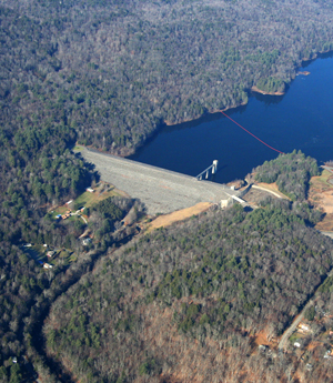
These Dams provide a valuable service to the area by allowing massive amounts of water to be stored on command. The obvious benefit these dams provide is protection from floodwaters, but Littleville Lake takes it a step further and uses the reservoir for their public water supply. Not only are these dams necessary for the smooth operation and safety of these areas, but they provide valuable recreation and conservation space in this beautiful environment.
This Dynamic Digital Map of Knightville and Littleville Dams will allow you to explore these functional landscapes and get an up close view of what the dams really look like and how they work.
The downloads below are standalone programs that run without other software. Simply unzip the zipped file sent, open the resulting folder, and start the program from within the folder. From the start up screen, use the yellow "WEB Access" button. Because the programs access their data (maps, images, figures, and movies) from a file server at UMass, and because they are using the web, they require a fast internet connection to run. All DDMs can alternatively access data from a CD, DVD or hard drives, if the data are available in those locations. To view any included movies, both Windows and Mac computers must have the latest QuickTime Player installed (free from Apple for both platforms, at www.apple.com). Please be sure Windows computers have their latest video drivers installed! Computers with less than 512 MB of free RAM will run these programs very slowly at best.