Download Access and a Description of the Macintosh Classic Program A Dynamic Digital Map of the Moon (DDM-Moon).
UMass-Amherst Department of Geosciences
Contribution No. 74
By
Christopher D. Condit ccondit@geo.umass.edu
Department of Geosciences, University of Massachusetts-Amherst
and
Richard C. Kozak, Glenn Bennett, Janet M. Barrett, Robert Mark, Ralph Aeschliman, Randolph L. Kirk and Ken Tanaka
Astrogeology Team, U.S. Geological Survey, Flagstaff, AZ
Funded by
National Science Foundation - Grant # NSF-DUE-CCLI-0127331 - to Chris Condit 2002-2005, the U.S. Geological Survey and the Department of the Interior
Welcome to the location that describes and provides a download for the Macintosh Classic stand-alone program Dynamic Digital Map of the Moon (DDM-Moon), and its associated media. The program was made with SuperCard, and although Chris no longer supports the program, due to requests, it is now made available here. Go here for access to the newer cross-platform, web enabled version of this program. Note that the SuperCard version still has many features not yet (26 Oct 2004) built into this later version).
The program and associated media can be obtained for $10 on CD-ROM from the UMass Contributions Series Page or by download of a very large (440 MB) archive DDM-Moon (693 MB expanded).
DDM-Moon is an interactive, hypermedia computer-graphical atlas that provides access to a large vairety of maps, images and movies that are made available with the program.
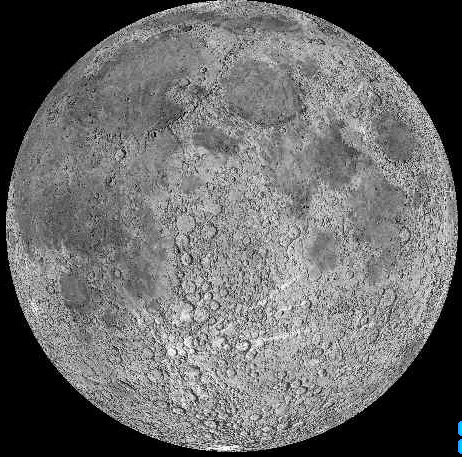
The program displays simultaneously up to ten map (image) mosaics at resolutions from 1/64 to 1/2 degree per pixel. Map products included are: Clementine mosaics, shaded relief±albedo, and geology (at 1/4 degree-scale) at resolutions from 1/64 to 1/2 degree per pixel. Access to maps is via mouse-click on either a rotating Lunar globe (a QuickTime Virtual Reality Movie), from a flat map projection, or from a searchable, sortable ClickList of Lunar Features (which will locate and highlight the feature).
Map images include labels showing all Lunar nomenclature; a click on the label displays that feature's nomenclature data (also accessible via ClickList). Once displayed, adjacent mosaics can be accessed via arrow-clicks, and higher or lower resolution images also accessed via command-clicks at the location of cursor. Images can be magnified/de-magnified (up to 16X), the cursor latitude-longitude location is displayed "real-time" on screen.
Measurements (distance, area) can be made on images, and saved in a tab-delimited file, with latitude-longitude coordinates. Various vector layers can be added or deleted from images (for example, geologic contacts and unit labels can be superposed on shaded relief maps); labels can be hidden/shown with a button-click. All images can be saved to external files retaining vector and raster format for use in CAD programs and printing on-demand.
A "Special Collections" library includes selected Lunar orbiter images, Apollo landing sites and various QuickTime Movies (for example Apollo astronauts, with sound, on the Lunar surface, and sequences of Ranger probes as they approach impact on the Moon's surface). Movies can be displayed simultaneously with background Special Collection images and with map mosaics.
A two-part "Automated Tour" that shows many of the program's features and how to use the program can be started via a single button click. The first part demonstrates the use of the maps and atlas features, the second shows the outreach features; each take about six minutes. A built in "Help" with many automated features is also included.
Acknowledgements:
Programming: Christopher D. Condit, Univ. Mass. at Amherst and Glenn Bennett, Janet M. Barrett and Robert Mark of the U.S. Geological Survey.
Conceptualization: Christopher D. Condit (Univ. Mass-Amherst), Richard C. Kozak, Glenn Bennett, Janet M. Barrett, Robert Mark, Randolph L. Kirk, and Ken Tanaka (USGS).
Specialties: Ralph Aeschliman (Artist, Photomosaicking), Jennifer Blue (Nomenclature), Robert Mark (QuickTime VR Globe), Jonathan Raye (Klingon Warrior Archivist) and Aaron Young (Map Image Projections), all at the USGS.
Comments to ccondit@geo.umass.edu
Updated 2004-03-23
Go to DDM Homepage
Go to UMass Geoscience Faculty Index
Go to Chris Condit's UMass Home Page