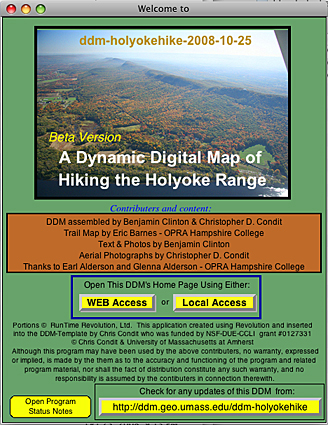
Downloads of the Dynamic Digital Map
of Hiking the Holyoke Range (DDM-Holyokehike)

(Cross-Platform Stand-Alone Programs Made with Revolution)

Benjamin Clinton and Chris Condit
Department of Geosciences - University of Massachusetts Amherst
Trail map by Eric Barnes - Hampshire College alum


Links to download the latest cross-platform, web enabled versions of the Dynamic Digital Map of Hiking the Holyoke Range (DDM-Holyokehike) are found below.

The Dynamic Digital Map of Hiking the Holyoke Range provides a virtual hiking trip, and is an excellent way to preview options available when hiking the range, and a way to look back at your experience after a trip. It also provides the most comprehensive way to examine all the bike trails of the range, including descriptions of each, along with difficulty ratings. For those unable to make the trip, it gives a way to experience a hike in one of the many beautiful areas of Western Massachusetts without actually walking the path. The range consists of a 7-mile ridge that runs from Hadley to Belchertown and is a patchwork of state, town and private lands. Consisting of over 3,000 acres, it is one of the largest parks in the state. The range formed 200 million years ago when lava flowed across the valley floor, cooled and was tilted to the south by faulting associated with the formation of the Connecticut rift valley. In places, between 3 million and 15,000 years ago, glaciers scoured ridge's jagged edges smooth, exposing bedrock, and depositing till, sand, clay. The 83 images create a good sense of the hike. There are ground and air photos for perspective, and videos of landform and structure, and also a background of the historic landmarks and places along the way. Vista photos in all directions will help provide a sense of place and direction. The first two thematic maps are topographic and orthophoto maps. A trail map, completed in 2005 by Hampshire College alum Eric Barnes, tops off the included maps; his trails are overlaid on the other two thematic maps for completeness. Please see the Hampshire College OPRA page for his version of the map.